Spain’s second summer heatwave will persist through Thursday. Afternoon storms with hail and strong winds are forecast for key inland regions. Mountain zones face the highest risk of severe weather.
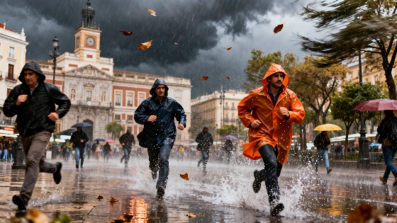
Spain’s ongoing heatwave is set to continue at least until Thursday, but the country now faces a new threat: a series of intense afternoon storms targeting much of the interior. Meteorological models indicate that the combination of high temperatures and atmospheric instability will bring heavy downpours, hail, and powerful wind gusts to several regions, especially in mountainous areas.
Shortwave disturbances and an approaching Atlantic trough are driving the development of these storms. On Monday, showers and thunderstorms are expected to break out across Castilla y León, Castilla-La Mancha, Extremadura, the Madrid highlands, eastern Andalusian sierras, and the southern parts of the Iberian System, including Teruel and inland Castellón. The risk is highest in elevated terrain, where hail and damaging winds are most likely.
Tuesday is forecast to be the most turbulent day, with storm activity spreading northward. The Cantabrian Mountains, the Iberian System, and the Pyrenees will see the most severe conditions. Regions such as Castilla y León, southern Aragón, eastern Castilla-La Mancha, and the interior of the Valencian Community are all on alert. The strongest storms are expected in Teruel, inland Castellón, Guadalajara, and northern Castilla y León, where wind gusts could be particularly intense across the northern plateau.
By midweek, the situation is expected to gradually stabilize. Wednesday should bring fewer storms, mainly affecting the Pyrenees and the surrounding areas of the Iberian System. Current forecasts suggest that Thursday will see similar patterns, with the most significant storms remaining in the Pyrenean region and weaker, isolated activity possible in the Iberian System and parts of the northern plateau.
Looking ahead to the end of the week, meteorologists are monitoring the approach of another Atlantic trough and a potential DANA (isolated high-level depression), which could bring renewed instability and a drop in temperatures. However, the outlook remains uncertain, and further updates are expected as the situation develops.
Severe weather has already impacted major events this summer. For example, the Mexico-England World Cup match was rescheduled to avoid dangerous storms, as detailed in this report on international sporting disruptions due to weather. Such incidents highlight the growing influence of extreme weather on daily life and public events across Europe.
Spain’s varied geography means that weather patterns can shift rapidly, especially in summer when heatwaves and storms often coincide. The combination of high temperatures and sudden storms increases the risk of flash flooding, property damage, and travel disruptions. Residents in affected regions are advised to monitor local forecasts and take precautions during periods of severe weather. The Spanish meteorological agency continues to issue regular updates and warnings as conditions evolve.