Spain faces another day of relentless storms as heavy rain and hail hit the north and central regions. Meteorologists warn of intense downpours, falling temperatures, and weather alerts across much of the country. The unsettled pattern is set to continue before a gradual return to stability.
Rain and hail slammed into wide stretches of Spain on Tuesday. This marked the sixth straight day of wild weather. Much of the country stayed on alert. The hardest rain hit the north and center. The Agencia Estatal de Meteorología (Aemet) warned that storms could break out almost anywhere on the peninsula. Meteoalerta, the national warning system, confirmed these were not just scattered local storms. The whole country faced a long spell of unstable weather.
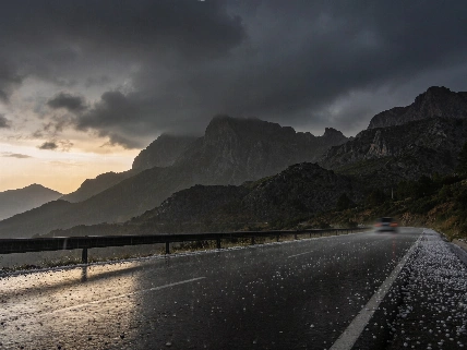
Rubén del Campo, Aemet's spokesperson, did not mince words: “Podrán caer casi en cualquier parte, aunque con mayor intensidad en zonas del tercio norte y del centro del área peninsular.” The forecast called for strong, sometimes very strong, rain. Extremadura, western Castilla-La Mancha, and the Sistema Central were in the crosshairs. Hail was a real threat. Residents and travelers had to stay alert. In the south, yellow alerts went out for Antequera and Ronda in Málaga province. Up to 15 mm of rain per hour, thunderstorms, and hail were all possible. Aemet's bulletins made that clear.
Regional forecasts for Andalusia indicated the potential for significant hail and strong wind gusts due to the formation of intense storm cells.
Weather maps showed nine autonomous communities under orange alerts for rain. That means real risk. Yellow alerts for storms covered even more ground. Aragón and Cataluña faced yellow warnings for thunderstorms. Andalucía, Asturias, Castilla y León, Castilla-La Mancha, Extremadura, Galicia, and the Comunidad de Madrid were under yellow for both rain and storms. The Balearic Islands could get isolated downpours. The Canary Islands braced for more showers. Independent reviews pointed out this was just the latest in a string of heavy rains. Eastern and northeastern Spain had already been hit hard in early October. The pattern would not let up.
Temperatures dropped across most of Spain. Only the Mediterranean coast saw the mercury climb. In the south of Comunidad Valenciana and Murcia, highs hovered near 30°C. Inland Galicia barely reached 20°C. The contrast was sharp. The weather made no sense. The most dangerous setup was in Catalonia. Forecasts for the coast and foothills of Tarragona, Barcelona, and Girona showed a risk of more than 200 mm of rain in 6 to 12 hours. Up to 40 mm could fall in just 30 minutes. Authorities got ready to send out emergency ES-Alert notifications. Flash floods and fast-rising rivers were a real risk.
Del Campo said Wednesday would bring an even bigger drop in temperatures. The north and the Canary Islands would feel it most. Instability would stick around. The heaviest rain would hit the northern third of Spain. The Cantabrian coast, northeast, and Balearic Islands faced strong, even persistent, rain. Thunderstorms and hail could follow. The north, center, and eastern interior would keep getting showers. The west and south might finally see some sun. In the Canary Islands, rain was likely in the north. Showers could pop up elsewhere.
In some areas of Castellón, more than 170 mm of rain had already fallen during the previous wave of storms, increasing the vulnerability of eastern regions to subsequent severe weather.
Yellow alerts for rain and storms stayed in place for Andalucía, Aragón, Cataluña, and Navarra. Asturias, Cantabria, and the Basque Country were under yellow for rain alone. By Thursday, things might start to settle. Anticyclonic conditions could return. But heavy rain could still hang on in the far north, Cataluña, and the Balearic Islands. Rain would ease off heading into the weekend. Temperatures would stay cool for now. A slow rebound was possible. Aemet said the Meteoalerta system would keep tracking and updating warnings for dangerous weather up to 72 hours ahead. The system would follow events as they happened.
Spain has seen sudden, severe weather before. Earlier flooding in Granollers after late storm warnings made headlines, as reported previously. This time, the episode stands out for how long it has lasted and how many regions it has hit. The stretch runs from Galicia to Madrid and from Aragón to Andalucía. Several independent publications noted that while hail and heavy rain were widespread, the most extreme rainfall and red-level alerts were mostly in Catalonia and in earlier or parallel periods. Not all of Spain faced the worst on October 6.
As Spain faces another round of wild skies, meteorologists have one message: stay alert. Temperatures and rain can swing fast. The weather can turn in minutes. For now, people hope for calmer days ahead. The past week proved how quickly storms can upend life across the peninsula.