Two Atlantic storms will hit Spain this week, triggering intense rainfall and a marked drop in temperatures. Galicia, Aragón, Catalonia and the Balearic Islands face the highest risk. Weather warnings remain in effect.
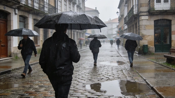
Spain faces a turbulent week as two Atlantic storms are set to sweep across the country, bringing heavy rainfall and a significant drop in temperatures. The first system, already active over Galicia and the northwest, has unleashed intense showers and increased cloud cover, particularly in coastal and inland areas. Authorities have issued weather warnings for several regions, with the most severe alerts in place for parts of Aragón, Catalonia and the northern Balearic Islands, especially Menorca, where rainfall could exceed 30 litres per square metre in just one hour.
The initial storm, with subtropical characteristics, will continue to affect the northwest through Monday and into Tuesday. Localized downpours in Galicia may reach 15 litres per square metre within an hour, and similar conditions are expected to extend into Extremadura, western Andalusia, Castilla-La Mancha and the western areas of Madrid. The northeast is also on alert for thunderstorms, some accompanied by hail, as cold air from the north interacts with humid Mediterranean flows. Meanwhile, the Valencian Community and other Mediterranean regions are experiencing a sharp increase in cloudiness, though rainfall there is expected to be less intense.
By midweek, a second Atlantic storm will approach, descending towards the northwest coast of Galicia between Wednesday and Thursday. This system will bring even colder air, ensuring that temperatures remain below seasonal averages across much of western Spain. Rainfall will again begin in the northwest and gradually spread eastward, though showers in central and eastern regions are likely to be more scattered. The northeast, however, could see renewed periods of intense rain as the system progresses.
Temperatures are forecast to fall in two distinct phases: the first drop will be most noticeable on Monday, with maximums in most provincial capitals staying below 30°C, except for some Mediterranean and Ebro Valley cities. A second, more widespread decrease is expected after the passage of the second storm later in the week. On Tuesday, temperatures will dip further in the northern third of the peninsula, while westerly winds may cause a slight rebound in the east and southern regions, including Andalusia. The Canary Islands will see little change, though increased cloud cover is likely in the north of the archipelago.
These weather developments follow a pattern of unusual summer storms that have affected Spain in recent years. For context, a recent Atlantic storm in August also triggered heavy rains and weather alerts across northern and eastern Spain, highlighting the growing variability of summer weather patterns.
Spain's meteorological agency continues to monitor the situation closely, urging residents in affected areas to stay informed about local warnings and to take precautions against flash flooding and sudden temperature changes. Such storm systems, while not unprecedented, can disrupt travel, agriculture and daily routines, especially in regions unaccustomed to intense summer rainfall. The current sequence of storms underscores the importance of timely weather updates and preparedness as climate patterns evolve.