Spain braces for a week of weather extremes. Heavy rain and storms will hit the northwest, while the Mediterranean remains under intense heat. The contrast will affect daily life and regional forecasts.
Spain is entering a week marked by a dramatic weather split, as two Atlantic storm systems approach the peninsula. While the northwest prepares for days of heavy rain and cooler air, the Mediterranean coast remains locked in a heatwave, with temperatures nearing 40°C. This sharp contrast is set to define the coming days, with practical consequences for residents and local authorities.
According to forecasts from Meteored meteorologist Duncan Wingen, the first Atlantic low-pressure system, currently west of Portugal, will weaken by Monday but leave behind unstable, cooler air in the mid-troposphere. This lingering instability will keep showers and storms active, especially in western regions. By Thursday, a new trough is expected to descend over the Atlantic side, potentially reigniting storm activity and prolonging unsettled conditions in the northwest.
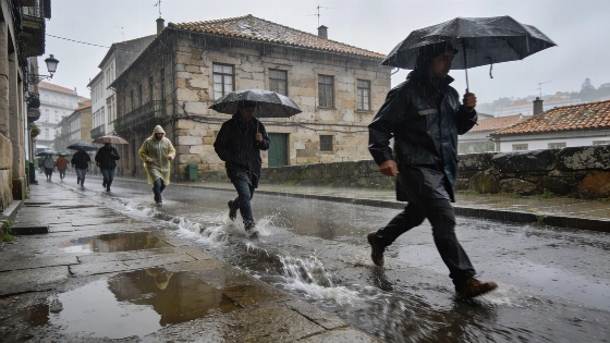
Between Monday and Friday, parts of Galicia could see rainfall totals exceeding 100 liters per square meter, particularly in the west and southwest of La Coruña and the Rías Baixas. Vigo is projected to be the wettest city in Spain, with up to 113 l/m² in just four days, based on European weather models. Significant rainfall—over 30 l/m²—is also forecast for much of Galicia, Asturias, the northwest of Castilla y León, and the Sierra de Gredos. In contrast, the southeast, including eastern Andalucía, Murcia, and southeastern Castilla-La Mancha, will see little to no rain, with some areas remaining completely dry. In the Canary Islands, showers will mainly affect the northern slopes of the higher islands, while Lanzarote and Fuerteventura are expected to stay dry.
Monday will bring widespread rain to the western half of the peninsula, with several rain bands moving in from Portugal. Galicia, Asturias, western Castilla y León, Sierra de Gredos, and Huelva could receive 10–20 l/m². By afternoon, convective clouds may trigger strong storms in northern Aragón and inland Catalonia. On Tuesday, as the first storm system dissipates, rainfall will decrease in intensity but persist in Galicia, Asturias, Cantabria, and possibly the Basque Country, with 10–30 l/m² expected. Showers will be moderate in the morning, evolving into more localized storms later in the day. Wednesday will see renewed instability as a new trough arrives, bringing further heavy rain to Galicia, Asturias, and northwest Castilla y León, with up to 40 l/m² in western La Coruña and Pontevedra. By Thursday, rain will continue in Galicia and spread across much of the Cantabrian coast, northern Navarra, Castilla y León, and northern Extremadura. From Friday, high pressure is forecast to build, gradually clearing skies and ending the rain, with a stable, dry weekend likely.
One of the most striking features of the week will be the temperature divide. While the west and north experience cooler, autumn-like conditions, the Mediterranean will endure persistent heat. Maximum temperatures are expected to reach 36–39°C in the Comunidad Valenciana, Catalonia, Murcia, the Balearic Islands, parts of the Ebro valley, and the eastern edge of Castilla y León. Meanwhile, Galicia, the northern plateau, and the Cantabrian coast will remain much cooler, with some areas not exceeding 27°C. Nights will also be unusually cold for the season in much of the interior, especially in the northwest, where minimums could drop below 15°C and even below 10°C in the northern plateau and mountain areas. In contrast, the Mediterranean coast will continue to see tropical or even torrid nights, sustained by the moderating effect of the sea.
This pattern of sharp contrasts is not new for Spain in recent years. As highlighted in recent coverage of sudden temperature drops and heavy rainfall, such weather swings have become more frequent, challenging local infrastructure and emergency planning. The current forecast underscores the need for residents in affected regions to stay alert for possible flooding, especially in Galicia, while those along the Mediterranean should prepare for continued high temperatures and the associated health risks.
Spain's varied geography often leads to significant regional differences in weather, with Atlantic systems bringing rain and cooler air to the northwest, while the Mediterranean remains under the influence of subtropical high pressure. This week’s forecast is a clear example of how these competing air masses can create sharp divides, impacting agriculture, water management, and daily routines. Authorities in regions expecting heavy rain are monitoring river levels and drainage systems, while health advisories remain in place for areas facing extreme heat. The situation highlights the importance of localized forecasts and preparedness as Spain navigates another week of meteorological contrasts.