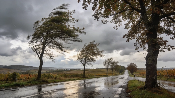
Carhaix-Plouguer faces a day of dense clouds, shifting winds, and intermittent rain on September 17. Morning gloom gives way to afternoon showers before late-day clearings, with temperatures fluctuating between 10 and 21°C.
Late in the afternoon, Carhaix-Plouguer finally gets a break: after hours of steady rain and thick clouds, the sun manages to push through for a short while. For locals, this brief brightness is a welcome change after a day spent under grey skies and damp air.
The morning starts off with a solid layer of cloud cover. Temperatures sit around 14°C at dawn and barely rise as the morning goes on. The air feels heavy with humidity, and a southwest wind—steady at 10 to 15 km/h, gusting up to 30 km/h—keeps things unsettled. Sunlight doesn’t appear until well into the afternoon. Regional meteorological reports note that this kind of persistent cloudiness and cool air matches the broader weather pattern across Brittany in mid-September 2026, when Carhaix-Plouguer saw highs of about 20°C and the region generally ranged between 18 and 24°C.
Meteorological bulletins for Brittany noted a marked shift to cooler, more unstable weather from September 16, with increased cloud cover and wind as frontal systems moved through the region.
By midday, the weather turns wetter. A steady drizzle sets in, then builds to moderate rain. The wind shifts from southwest to northwest and picks up to 15–20 km/h, with gusts reaching 40 km/h. Temperatures climb to 17–19°C, but the dampness sticks around. As the afternoon goes on, the rain finally lets up and the sky opens a little, letting in some light. This matches what Météo-France described: after a warm start to September, Brittany was moving into a cooler, more changeable stretch, with more wind and leftover humidity as weather fronts crossed the northwest of France.
Evening brings a short-lived calm. Temperatures start near 18°C and drop to 14°C by nightfall. The sky clears a bit, then clouds over again before clearing once more late at night. Winds from the northwest blow at 20 km/h with gusts up to 35 km/h, but gradually ease and turn west, dropping to a light 5 km/h. Humidity rises again, setting up a damp night. This fits the pattern seen in the days around September 17, with forecasts pointing to ongoing unsettled weather and no quick return to stable conditions.
Overnight, things quiet down. Temperatures fall to between 10 and 12°C, with the lowest readings just before dawn. Winds stay light, shifting from southwest to west-southwest, rarely topping 5 km/h, and gusts remain modest at about 10 km/h. The sky alternates between clear and cloudy, but by sunrise, thick clouds are back. Humidity stays high through the night.
According to Météo-France, the period from September 14 to 17, 2026, marked a clear transition in Brittany from the warmth of early September to a more unsettled and cooler regime, with cloudiness, humidity, and only gradual clearing. This shift was not an anomaly but part of a broader regional pattern, as anticyclonic conditions weakened and frontal systems brought increased variability.
The next day offers little change. Early morning temperatures start at 10–11°C, rising to 20–21°C by afternoon. Winds begin weak from the southwest, then strengthen and turn west, reaching 15 km/h with gusts up to 35 km/h. The sky stays mostly overcast, with only a brief thinning of clouds around midday before thickening again later. Forecasts from Ouest-France confirm that this lack of lasting improvement and the steady, moderate temperatures are typical of the unstable air masses still affecting the region.
For Carhaix-Plouguer, the day is a reminder of how quickly Brittany’s weather can shift. Anyone heading outside will need to be ready for changing skies, rain, and wind—rain gear and flexibility are a must. The forecast points to a classic Breton transition: unsettled, unpredictable, and always worth watching.