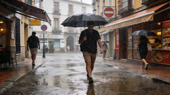
Spain faces a turbulent week as DANA brings storms and a trough increases instability. Weather warnings are active in several regions. Temperatures are set to fall, especially in the north.
Spain is bracing for a week of unstable weather as a DANA (isolated high-level depression) continues to influence conditions across the country. After a weekend marked by widespread and intense storms, particularly on Saturday, the DANA is now shifting southwest, but its proximity to the peninsula will keep instability high in the coming days. Authorities have issued yellow alerts for storms and heavy rainfall in multiple regions, with the risk of hail and strong wind gusts in mountainous areas.
On Monday, the DANA is expected to be positioned between the Gulf of Cádiz and the Canary Islands. Its lingering effects will bring showers and thunderstorms to parts of Andalusia, Extremadura, and Castilla-La Mancha. Mountain zones in these communities could see more severe weather, including hail and sudden wind bursts. Additional showers are forecast for southern Aragón, the Cantabrian Mountains, and the Pyrenees, where rainfall could exceed 15-20 mm in just one hour.
By Tuesday, the DANA will move slightly further west, allowing a ridge of high pressure to bring a brief period of stability. However, isolated showers or storms may still develop in the Pyrenees and the Iberian System. The situation changes again midweek as the DANA is drawn back toward the peninsula and absorbed by an advancing Atlantic trough. This will trigger a new surge of instability on Wednesday, with afternoon storms expected in inland Galicia, the Cantabrian coast, eastern Andalusia, Murcia, southern and eastern Castilla-La Mancha, as well as the Iberian System and the Pyrenees. In these areas, storms could be intense, with hail and very strong winds possible.
From Thursday, the trough that absorbs the DANA will dominate Spain's weather. It will move in from the northwest, bringing widespread showers and potentially severe storms to much of northern Spain, especially Galicia, Asturias, Cantabria, and northern Castilla y León. Central, southern, and eastern regions, including the Balearic Islands, may also see showers, though these are expected to be less intense. The southeast, particularly the eastern mountains of Andalusia, Murcia, and southeast Castilla-La Mancha, could experience stronger storms. On Friday, as the trough advances, the heaviest rainfall is likely in the northern third of the peninsula, with Cantabria and the Basque Country facing the most intense morning storms, followed by the Pyrenees, the Iberian System, and Catalonia in the afternoon.
According to the latest forecasts, this pattern of instability is set to persist throughout the week, with rain and storms continuing in many areas, especially in northern Spain. The ongoing unsettled conditions follow a period of extreme weather, as highlighted in recent coverage of Spain's rapid weather shifts after DANA events. Residents are advised to monitor local alerts and prepare for sudden changes in weather, particularly in regions under warning.
Spain's climate is characterized by sharp contrasts, with Atlantic systems often bringing rapid shifts from heat to storms. The DANA phenomenon, common in late summer and early autumn, can cause localized flooding and disrupt transport and daily life. The current sequence of DANA followed by a trough is not unusual for this time of year, but the intensity of storms and the speed of temperature drops highlight the need for vigilance. Meteorological agencies continue to update warnings as conditions evolve, and local authorities may issue further advisories if the situation worsens. For those living in or traveling through affected regions, staying informed and taking precautions remains essential during periods of heightened weather risk.