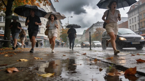
Germany faces a dramatic weather reversal this week. After temperatures soared to 33°C, a rapid drop brings storms, heavy rain and a chill. The shift marks the end of summer heat and signals unsettled days ahead.
Germany’s late summer heatwave ended abruptly this week. After a single day with highs up to 33°C in the southwest, the country is now facing a sharp drop in temperature, storms, and widespread rain. The last real heat of the year disappeared almost overnight.
Monday’s warmth came from an unusual mix of weather systems. A deep low near Iceland turned into a storm, pushing a high-pressure ridge over Central Europe further north. This brought hot, humid air from the southwest, sending temperatures up—especially in the southwest, where they reached 30 to 33°C. Even the northeast, usually cooler, saw peaks of 24°C. The German Weather Service (DWD) marked September 7 as likely the final heat day for 2026. DWD warned that after this brief heat, a quick reversal would follow, with heavy rain, thunderstorms, and gusty winds, especially in northern and central Germany. On the same day, forecasts showed the south could still reach 26–32°C, while the north was already seeing rain and squally winds.
In early September, nighttime temperatures in much of Germany dropped to single digits outside coastal areas, confirming the rapid retreat of summer heat.
The heat didn’t last. By Tuesday, a rain front moved in from the northwest, quickly ending the summer mood. The southeast held onto sun and warmth for a few more hours—temperatures along the Inn River still touched 31°C—but showers and thunderstorms soon arrived. The evening brought rain, hail, storm gusts, and the risk of flash flooding, especially south of a Saarland–Berlin line. DWD warned of possible severe weather, including local flooding and hailstorms. In several regions, including Baden-Württemberg and northern states, DWD issued official warnings for strong thunderstorms, heavy downpours, and hail, noting the risk of sudden flooding and storm damage, as reported by major German news outlets.
By Wednesday, the change was clear. In the south, temperatures dropped to just 16°C—a 17-degree fall in a single day. The north faced gusty winds and scattered thunderstorms, while central regions saw brief sunny spells between showers. DWD reported highs of only 17 to 21°C, a sharp contrast to the start of the week. The southeast stayed wet, with steady rain near the Alps and east of the Bodensee–Dresden line. Elsewhere, the weather turned unsettled, with the coast seeing more frequent showers and occasional short storms. Meteorological reviews noted a high risk of stormy weather along the North Sea and Baltic Sea coasts, where Atlantic fronts brought strong southwesterly winds and unstable conditions.
The unsettled weather is set to continue. By Friday, another Atlantic front will move in from the west, bringing thicker clouds and spreading rain across much of the country. Areas north of a Mannheim–Usedom line could see heavy rain by evening, with the east and southeast following overnight. Southwest winds will pick up, and daytime highs will struggle to reach 15 to 20°C—dropping even lower where rain lingers. The quick shift from 33°C heat to autumn chill is now complete.
The summer of 2026 in Germany was among the hottest on record, with around 22 days reaching at least 30°C and about 5 days exceeding 35°C nationwide. This exceptional heat set the stage for the dramatic weather reversal at the start of meteorological autumn.
DW
Such swings aren’t new for Europe. Last year, Barcelona set a September heat record, as reported earlier, showing how unpredictable late-summer weather can be across the continent. For Germany, this week’s reversal is a reminder of how quickly conditions can change, with real effects on travel, agriculture, and daily life. The DWD’s warnings about storms, hail, and flooding reflect real risks for people and businesses caught off guard by the speed of the change. As September continues, summer is over and the new season has arrived with force. How disruptive this transition becomes will depend on how quickly authorities and the public adapt, but the days of stable warmth are now behind.