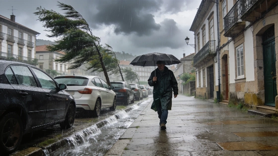
A powerful Atlantic front sweeps across Spain, causing a rapid fall in temperatures and widespread rain. Galicia faces intense showers and storms, while strong winds affect mountain areas. Mediterranean coasts remain hot.
Spain faces a dramatic shift in weather as a deep Atlantic storm system moves in from the northwest, bringing a marked drop in temperatures and widespread rainfall. The front, linked to a powerful low-pressure area near the British Isles, is sweeping from west to east, covering much of the peninsula with thick clouds and persistent rain. The most severe conditions are expected in southwestern Galicia, where heavy downpours and thunderstorms are likely to continue throughout the day.
As the system advances, rain will spread into Asturias, western Castilla y León, Extremadura, and the Cantabrian mountains. These areas will see showers gradually ease as the cloud cover shifts eastward. However, the Pyrenees are set for locally intense afternoon storms, driven by daytime heating and unstable air. The weather pattern mirrors recent events, such as those described in reports of persistent storms and temperature drops in northern Spain.
One of the most notable impacts is the sharp and widespread fall in maximum temperatures. The interior, especially the northern plateau and river valleys in the northwest, will experience the most significant cooling. In contrast, Mediterranean coastal and pre-coastal areas will largely escape the chill. Here, thermometers are expected to climb above 35°C in parts of the Ebro valley, the Valencian pre-coast, the southeast, and Mallorca. The Balearic Islands will also see tropical nights, with minimum temperatures staying above 20°C, and may experience episodes of haze and muddy rain.
Minimum temperatures will drop across most of the peninsula, except in the Guadalquivir valley, Catalonia, and the islands, where they will remain steady or even rise. Winds will be another key factor, blowing moderately across much of Spain but reaching strong to very strong gusts in the higher elevations of the northern mountains. The Guadarrama range, the Iberian System, and the Cantabrian mountains are particularly at risk for severe wind conditions. In the Canary Islands, the tail end of the front will bring cloudy skies and moderate rain to the northern slopes of the mountainous islands, along with a drop in maximum temperatures and moderate northerly winds shifting to the northeast.
Spain's varied geography often leads to sharp contrasts in weather, especially when Atlantic systems interact with local conditions. Galicia and the northern regions are frequently the first to feel the impact of such fronts, while Mediterranean areas can remain hot and dry even as the rest of the country cools. The combination of strong winds, heavy rain, and sudden temperature changes can disrupt daily life, affecting transport, agriculture, and outdoor activities. According to meteorological data, these patterns are typical for late summer, but the intensity of this front stands out. Residents in affected areas are advised to stay updated on local forecasts and take precautions, especially in regions prone to flooding or strong winds.