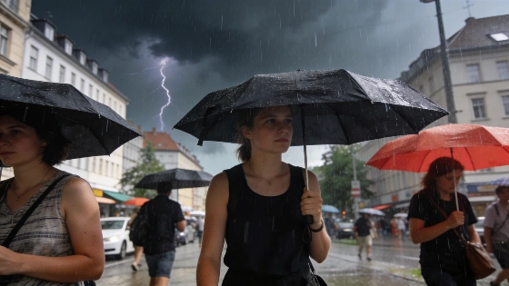
Germany is split into three weather zones this week. The south faces storms and heavy rain, while the centre enjoys summer sun. The north remains unsettled with frequent showers and cooler air.
Germany is entering a period of pronounced weather contrasts, with the country divided into three distinct zones. In the coming days, residents will experience sharply different conditions depending on their region. The south, including Bavaria and Baden-Württemberg, is bracing for repeated thunderstorms and the risk of severe downpours. Central areas from Saarbrücken through Frankfurt to Leipzig and Berlin are set for the most stable summer weather, while the north, from Hannover to Hamburg and Sylt, faces a high chance of rain and cooler temperatures.
In the southern states, the situation is particularly tense. Cities such as Nuremberg, Stuttgart and Munich are expected to see frequent heavy showers and thunderstorms, with localised risks of severe weather. Strong winds and intense rainfall are possible, raising concerns about flooding in some areas. Despite the unsettled skies, temperatures will remain warm, reaching up to 27°C, and the air will feel increasingly humid, according to climatologist Dr. Karsten Brandt.
Meanwhile, central Germany is forecast to enjoy the most pleasant conditions. A mix of sun and clouds will dominate, with temperatures around 25°C and only a 20% chance of rain. The air will feel noticeably fresher compared to the south, and winds are expected to stay light to moderate. For many, Thursday could bring the best weather of the week in these regions.
In contrast, the north will continue to see unsettled conditions. Rain is likely for much of the day, with a 70% probability in places like Hannover, Hamburg and along the North Sea coast. Temperatures will peak at 23°C, and residents should expect frequent showers and occasional thunderstorms, though there will be brief sunny intervals between the rain.
Looking ahead to Friday, the weather remains changeable. Showers and thunderstorms are expected to become more widespread in the northwest, and rain may also spread from the southwest. Fog could develop in some areas. However, regions between northern Hesse and the northeast are likely to see drier and brighter conditions, with afternoon temperatures ranging from 19°C to 25°C and light winds.
The weekend brings a shift towards more settled weather. Saturday is forecast to be generally friendlier across the country, with temperatures rising to between 22°C and 25°C. While isolated showers are still possible, summer conditions are expected to return for most regions. Sunday should continue this trend, offering dry weather and comfortable temperatures up to 23°C in many areas.
Extreme heat is not expected to return in the near future. Instead, Germany is set for a late-summer mix of mild warmth, sunny spells and only occasional showers. This pattern stands in contrast to recent weather events elsewhere in Europe, such as the sudden temperature drop and heavy rainfall that affected Spain earlier this month, as reported in a recent analysis of Spain's August weather shift.
Dr. Karsten Brandt, who holds a doctorate in climatology from the University of Duisburg-Essen and leads the Donnerwetter.de portal, notes that while the current situation brings challenges for some regions, the overall outlook points to a stable and comfortable end to the summer for most of Germany. For context, Germany's climate is shaped by its central European location, with maritime influences from the west and continental air masses from the east. This often leads to rapid weather changes, especially in transitional seasons. The current division into three zones highlights the complexity of forecasting in such a varied landscape, and underscores the importance of local updates for residents planning travel or outdoor activities.