
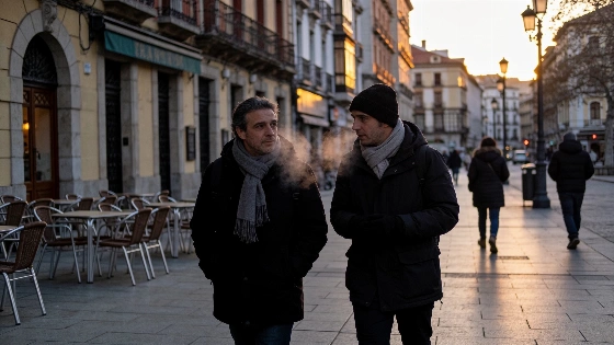
A blast of polar air is sweeping into Spain, knocking down daytime highs and setting up the coldest nights so far this autumn. As storms move out, northern and inland regions brace for a sharp drop in temperatures.
Spain is bracing for a sudden cold snap as polar air barrels in from the north. The recent run of storms is ending, but now the country faces its coldest nights of the season. The north will feel it first. In Asturias, the Basque Country, and northern Navarra, maximum temperatures are set to tumble by 6 to 8 degrees Celsius. Spain's national weather agency, AEMET, ties this abrupt shift to a surge of high pressure over the Atlantic and a cold upper-level system between France and Italy. That setup is funneling frigid air straight down over the peninsula.
Storms have hammered parts of Spain in recent days, with some areas on flood watch. Now, the story is the rapid drop in temperatures. The polar air mass, paired with a steady northerly wind, will drag down both daytime and nighttime readings. Ávila, León, Palencia, and Salamanca are all forecast to see highs fall to just 18–19ºC. The meseta norte may not even reach 20ºC. AEMET's Meteoalerta system is still pushing out warnings for dangerous weather. Residents are urged to check these alerts for the latest on storms, heavy rain, and flood risks.
By the end of the week, maximum temperatures could fall by 5–9°C in Castilla-La Mancha, Madrid, Aragón, Catalonia, and the Balearic Islands, with some foothill and Pyrenean areas of Huesca seeing drops of around 10°C.
Down south, the Mediterranean coast and the Ebro valley will hang onto a bit more warmth, with highs between 24 and 27ºC. Sevilla and Murcia could even see 28ºC. But that won't last. By Thursday, the cold will tighten its grip on the northern half of Spain. La Rioja, the Basque Country's interior, and Cantabria are all in line for another 6–8ºC drop in daytime highs. The chill will reach the center, the Mediterranean coast, and the Balearic Islands by Friday, according to independent meteorological reports.
Nights will turn even colder. After a stretch of mild, damp evenings thanks to rain and clouds, the next few days will bring a sharp contrast. Minimum temperatures are set to dip below 10ºC across much of the northern interior—Galicia, the Cantabrian region, La Rioja, Navarra, Castilla y León, Aragón, and inland Catalonia. In some cities in Castilla y León and northern Castilla-La Mancha, early mornings could see the mercury drop to 5–7ºC. Madrid and Extremadura may also wake up to single-digit lows. Marca reports that in some spots, minimums could hit −2ºC, and in Ávila, Segovia, and Teruel, lows of 3–4ºC are expected. That means the first frosts of the season could hit higher and inland areas.
The coldest nights are expected between Wednesday and Saturday, with Friday and Saturday mornings likely to be the chilliest. Even so, the south and the Canary Islands will stay relatively mild. Highs could still reach 27–28ºC in Andalucía and Murcia. This north-south split is striking. El País noted that while the north and center have battled storms and falling temperatures, the southern Valencian Community and Murcia have clung to nearly 30ºC, showing just how sharply Spain's climate can vary.
The recent cold snap does not signal the start of a sustained cold season. AEMET's seasonal forecast for October to December indicates a high probability of above-average temperatures across Spain, suggesting this episode is a brief cold phase rather than a lasting shift to winter conditions.
As the weekend and the Puente del Pilar holiday approach, temperatures are expected to edge up a bit, especially as the weather settles. Still, the overall pattern will stay cool, with only a slow warming trend on the horizon. Anyone planning to spend time outdoors should be ready for brisk mornings and evenings, especially in the north and inland. Vozpópuli reports that temperatures may start to climb again from the weekend, lining up with more stable weather during the Pilar holiday, but the general backdrop will stay on the mild side.
This sharp swing from storms to cold isn't new for Spain, but the size of the temperature drop stands out this year. As reported earlier, the Pilar holiday often brings wild weather, but this time the polar air mass is set to leave its mark with a widespread chill and a quick end to the recent warmth.
This week’s weather is a clear sign of how fast autumn can take hold in Spain when polar air moves in. The coming days will have many people digging out coats and turning up the heat. For much of the country, the sudden cold is a blunt reminder that summer is truly over. This kind of sharp cooling is a classic part of the Spanish autumn, showing just how much the country’s climate can swing—from flooding rains to the first real taste of winter in a matter of days.