Spain faces a day of intense storms in the north and dangerous heat in the south and east. Authorities have issued multiple weather warnings. Key regions brace for disruption and health risks.
Spain is experiencing a sharp weather divide this Sunday, as severe storms threaten Navarra and northern Aragón while much of the south and east faces dangerously high temperatures. The national meteorological agency has issued orange alerts for extreme heat in Andalucía, Aragón, Baleares and Catalonia, with yellow warnings extending to Castilla La Mancha, Madrid, Murcia, Navarra and the Valencian Community. Additional orange and yellow alerts are in place for storms in several of these regions.
In Navarra and northern Aragón, forecasters expect intense showers and thunderstorms, some potentially very strong, bringing hail and powerful wind gusts. The risk of severe weather extends, though with less probability, to nearby areas and parts of the southeast interior. These conditions are driven by a cold air mass at higher altitudes, which is increasing atmospheric instability, especially from midday onwards. The rest of the Peninsula will see mostly clear or lightly clouded skies, except for Galicia and the Cantabrian coast, where overcast conditions will persist, and the Alborán coast, which will experience intervals of low clouds.
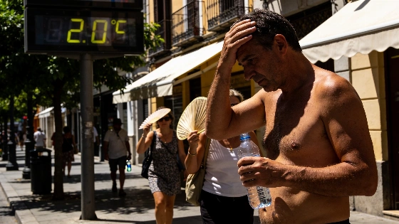
Meanwhile, the heat is set to intensify across Baleares, Andalucía, the southern plateau and the eastern half of the Peninsula. Maximum temperatures are expected to exceed 35°C in large parts of the south and northeast, as well as in the Balearic Islands. In the Guadalquivir and Ebro valleys, thermometers could reach 40°C. Nighttime will bring little relief, with tropical nights—minimums above 20°C—likely in much of the southeast and the islands, and some Mediterranean coastal areas not dropping below 25°C. In contrast, cooler conditions are forecast for the Cantabrian region, the western third of the country and the Canary Islands, where maximums will fall and trade winds may bring strong gusts.
Stable weather will dominate the archipelagos, except for some low clouds in northern Canary Islands. Coastal fog and mist are probable in Alborán, Galicia and Asturias, occasionally reaching inland areas during early and late hours. Light haze is also expected in the Canary Islands and the southern and western parts of the Peninsula. Winds will generally be light, though the Canary Islands may see strong intervals and very strong gusts, while moderate northwesterlies are forecast for the Gulf of Cádiz, southerlies in Ampurdán, and easterlies in Baleares. Elsewhere, winds will pick up in the afternoon, mainly from the west, except in the eastern and northeastern coastal areas, where southern and eastern components will prevail.
These weather extremes come as Spain continues to grapple with the consequences of climate volatility. Recent months have seen a series of disruptive events, including major wildfires that devastated parts of Ávila and Vall d’Uixó. The ongoing investigation into those incidents, as detailed in this report on the causes behind Spain’s July megafires, highlights the growing challenges posed by severe weather patterns. Authorities are urging residents and visitors in affected regions to remain vigilant, follow official guidance, and take precautions against both heat-related health risks and sudden storms. The current alerts underscore the need for preparedness as Spain faces another day of unpredictable and potentially hazardous weather.
Spain’s weather warning system uses a color-coded scale: orange indicates significant risk requiring action, while yellow signals potential danger. The combination of high temperatures and violent storms can strain emergency services and disrupt daily life, especially in regions unaccustomed to such extremes. The country’s diverse geography means that while some areas endure oppressive heat, others may face flash floods or hail damage within the same day. These patterns reflect broader climate trends affecting southern Europe, where heatwaves and severe storms are becoming more frequent and intense. Residents are advised to monitor updates from local authorities and the meteorological agency, particularly as conditions can change rapidly.