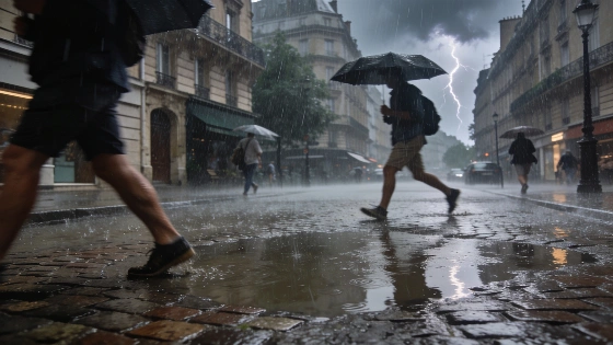
After a series of heatwaves, France faces a sharp weather shift. Intense storms and heavy rainfall are forecast for Thursday and Friday. Authorities have issued multiple weather alerts across the country.
France is bracing for a significant change in weather as intense storms and heavy rainfall are forecast to sweep across several regions on Thursday, 20 August, and Friday, 21 August 2026. Following a period marked by repeated heatwaves, the arrival of a new Atlantic anticyclone is pushing out the lingering hot air, ending the fifth heatwave of the summer. As of Tuesday, Météo France had lifted all orange heatwave alerts, but the risk of severe weather remains high in many areas.
On Wednesday, the northwest of the country experienced persistent rain as a depression from Ireland settled over Brittany and moved northward toward Paris and the Ardennes. Winds from the west to southwest reached up to 40 km/h by late afternoon. Despite the easing of heatwave alerts, 22 departments remained under yellow vigilance for heat and 20 for thunderstorms, highlighting the ongoing instability.
Thursday is expected to bring a marked deterioration in weather conditions. The departing depression will leave behind a low-pressure axis, creating an environment ripe for thunderstorms and a noticeable drop in temperatures. The afternoon should see some clear spells, but moderate southwesterly winds around 20 km/h are likely. The most significant storm risk is forecast from Aquitaine through the centre-east and southeast, with particular attention on areas around Lyon, the Jura, Drôme, Vaucluse, and the Alpes-Maritimes. Localized severe storms are possible, with the potential for heavy rainfall and hail.
The eastern Mediterranean coast faces an elevated risk of intense precipitation, with meteorological signals pointing to a possible Mediterranean episode. Météo France has already placed 39 departments under yellow alert for storms, rain-flooding, and lingering heat for Thursday. The situation is being closely monitored, especially in regions that have recently experienced severe weather damage.
By Friday, conditions are expected to gradually improve across much of France. The strengthening anticyclone west of the British Isles will block new disturbances from the west and shift winds to a northerly direction. However, the risk of storms and heavy rain will persist in the south, particularly in the southeast and Mediterranean regions. Elsewhere, the weather should be calmer, with only light rain possible in the northern Paris Basin.
The weekend is forecast to be more settled, with dry and cooler conditions dominating on Sunday. Isolated storms may still develop on Saturday, especially in the southwest, where a lingering depression could trigger further rain and thunderstorms by Tuesday, 25 August, particularly in central France. Maximum temperatures are expected to range between 20 and 22°C, reducing the likelihood of another heatwave before the end of the month.
Recent weeks have seen France repeatedly affected by extreme weather, including violent storms and flooding in the Pyrenees. This pattern of alternating heatwaves and severe storms has also been observed in neighboring countries. For example, Spain recently faced a rapid return of high temperatures and fire risks after a DANA weather event, as detailed in this report on the renewed heat and storm warnings in Spain. Such fluctuations highlight the ongoing challenges posed by unstable summer weather across Western Europe.
For context, Météo France's vigilance system uses yellow, orange, and red alerts to inform the public about weather risks. Yellow indicates a need for caution, while orange and red signal more severe threats. The current alerts reflect both the end of the heatwave and the onset of potentially dangerous storms. Residents in affected regions are advised to stay updated on local forecasts and heed any official warnings, especially in areas prone to flooding or severe thunderstorms.