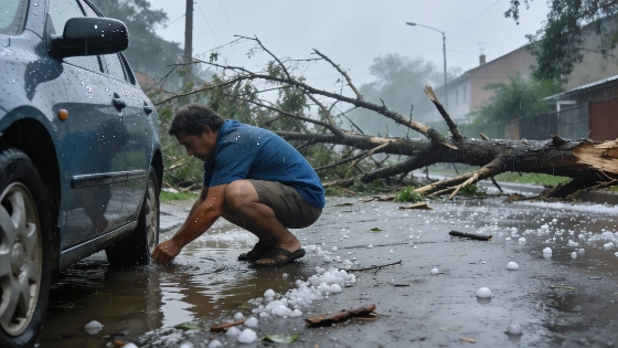
Corsica and parts of southeast France were struck by intense storms on Friday. Heavy rainfall, hail, and wind gusts caused disruptions. Authorities issued yellow alerts as the weather system moved toward Italy.
On Friday, a powerful wave of thunderstorms swept across Corsica and the southeast of France, triggering yellow weather alerts in Corse-du-Sud and Haute-Corse. The storms brought sudden, intense rainfall, hail, and damaging wind gusts, with some areas recording up to 130 km/h. The most severe weather was concentrated between midday and late afternoon, affecting regions from Languedoc and the Rhône valley to the Alps and the island of Corsica.
Rainfall totals were significant, with 30 to 50 mm falling in less than an hour in many locations. In some spots, accumulations reached between 100 and 130 mm. The storms also produced a high level of lightning activity and hail, adding to the disruption. Wind speeds peaked at 125 km/h in Tarbes, 100 km/h in Marignana, and 110 km/h on Cap Corse, while mountainous areas of Corsica experienced gusts up to 90 km/h.
By early afternoon, the most active storm cells began moving eastward toward Italy, but Corsica remained under alert as further thunderstorms were expected to develop. The Bouches-de-Bonifacio and Corsican mountains saw lingering storm activity, with strong winds persisting across the island. Authorities anticipated a return to calmer conditions by late afternoon, with the alert expected to be lifted as the weather system exited the region.
Over the previous 24 hours, the heaviest rainfall was recorded in the southeast and near the Pyrenees. Notable totals included 133.7 mm in Levens (Alpes-Maritimes), 122.1 mm in Tende-Saint-Dalmas, and over 100 mm in several other locations such as Puy-Saint-Martin and Bénéjacq. The storms caused localized flooding and hazardous travel conditions, particularly in areas with the highest rainfall.
Looking ahead, meteorologists forecast a relative lull on Saturday, though isolated storms could still develop in southern and mountainous regions. A more organized weather system may approach from the southwest by Monday, potentially bringing renewed risks of heavy rain and thunderstorms to areas south of the Loire. However, the exact location and intensity of future rainfall remain uncertain and will require updated forecasts.
This episode follows a pattern of unusual summer storms affecting southern Europe in recent years. For comparison, a recent Atlantic storm also triggered rare weather alerts in northern Spain, highlighting the growing unpredictability of severe weather events across the region.
Corsica's experience underscores the importance of timely weather warnings and preparedness, especially as climate patterns continue to shift. The rapid escalation and intensity of Friday's storms serve as a reminder of the potential for sudden disruptions, even outside the traditional storm season. Residents and authorities in affected areas remain vigilant as the summer progresses and weather risks evolve.