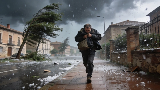
A cold air mass triggers intense storms in northern Spain, with hail and strong winds in Navarra and Aragón. Meanwhile, southern and eastern regions continue to face extreme heat, with temperatures nearing 40°C.
Spain faces a sharp weather divide this Sunday as a cold air mass at high altitude sweeps into the north, unleashing severe storms in Navarra and northern Aragón. According to the latest forecast from AEMET, these storms are expected to bring hail and powerful wind gusts, disrupting what began as a calm day across much of the country.
While the north braces for turbulent conditions, the south and east remain under the grip of intense heat. Regions such as Andalucía, the Balearic Islands, the southern plateau, and the eastern half of the peninsula are set to record notably high temperatures, with some areas likely to exceed 38°C. In Palma, the mercury could reach 38°C, and in the valleys of the Guadalquivir and Ebro, temperatures may approach the 40°C mark. Cities like Córdoba, Toledo, Ciudad Real, and Zaragoza are all forecast to see highs above 38–39°C.
The day starts quietly for most, with clear or lightly clouded skies, except in Galicia and the Cantabrian coast, where overcast conditions persist, and along the Alborán coast, where low clouds are expected. However, as the morning progresses, the arrival of the cold air mass will drive the rapid development of storm clouds in the north and east. AEMET warns that these storms could be locally very strong, especially in Navarra and northern Aragón, with hail and damaging winds possible. There is also a chance, though lower, that storms could spread to nearby areas and parts of the southeastern interior.
Elsewhere, both the Canary and Balearic Islands are expected to avoid the instability, maintaining stable weather with mostly clear skies, except for some low clouds in northern Canary areas. Coastal fog and mist may form along the Alborán, Galicia, and Asturias coasts, potentially reaching inland areas at the start and end of the day. A light haze is also forecast for the Canary Islands and the southern and western parts of the peninsula.
Temperature trends will vary: maximums will drop in the Cantabrian region, the western third of the peninsula, and the Canary Islands, but rise in the Balearics and northeast, with little change elsewhere. Nighttime minimums will fall in the west and Canary Islands but remain steady in other regions. Tropical nights—where temperatures do not fall below 25°C—will persist in much of the southeastern peninsula and both archipelagos, especially along the Mediterranean coast.
Winds will be another key factor. The Canary Islands will experience strong trade winds with possible very strong gusts. The Gulf of Cádiz will see moderate northwesterly winds, while the Ampurdán will have moderate southerlies and the Balearics easterlies. Across the rest of Spain, winds will generally be light but are expected to strengthen in the afternoon, with a predominance of westerly winds except in the eastern and northeastern regions, where southerly and easterly winds will take over.
In the Canary Islands, Las Palmas de Gran Canaria will see temperatures between 23°C and 27°C, and Santa Cruz de Tenerife between 24°C and 31°C. The contrast between the stormy north and the sweltering south will define the weather picture for Spain this Sunday. This pattern of sharp regional contrasts echoes the challenges faced by emergency services during recent extreme weather events, such as those described in reports on persistent wildfires near Huelva, where shifting winds and dry air complicated firefighting efforts—see the detailed account at how changing weather conditions have impacted emergency responses in Spain.
Spain's climate is marked by significant regional differences, often leading to simultaneous weather extremes. The AEMET regularly issues alerts for both heatwaves and severe storms, especially during the summer months. Residents in affected areas are advised to monitor official updates and take precautions against both heat and sudden storms. The ongoing pattern highlights the importance of preparedness and adaptation as weather volatility becomes increasingly common across the country.