Temperatures above 40°C are forecast in several Spanish regions this week. Saharan dust and wildfire smoke will worsen air quality. Authorities warn of persistent fire risks and unstable weather patterns.
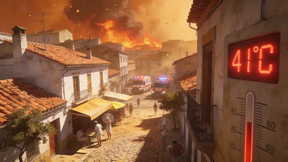
Spain is bracing for another intense heatwave as temperatures are set to climb above 40°C in multiple regions this week. The surge in heat will be accompanied by Saharan dust and lingering smoke from ongoing wildfires, creating challenging conditions for residents and emergency services. The return of high temperatures comes after a brief respite over the weekend, with the latest forecasts indicating that the heat will intensify through midweek before a possible drop in some areas.
Weather models show that the Cantabrian region, along with parts of the interior and south, will experience the most severe temperature spikes. Cities such as Ourense, Zaragoza, Toledo, Ciudad Real, Jaén, Granada, Sevilla, Córdoba, Badajoz, and Cáceres are expected to see daytime highs reach or exceed 40°C. Nighttime relief will be limited, with tropical or even equatorial nights predicted in several provincial capitals. In Almería and Cádiz, minimum temperatures may not fall below 25°C, raising concerns about heat stress and public health.
The meteorological shift is driven by the retreat of a cold air trough to the east and the reestablishment of a strong anticyclonic ridge over the peninsula. This pattern brings calm winds and a steady influx of hot, dry air from North Africa. The result is not only soaring temperatures but also a marked increase in humidity and discomfort, especially in the southern half of the country. The presence of Saharan dust, or calima, will be particularly noticeable, reducing visibility and further degrading air quality in affected provinces.
Rainfall is expected to be scarce throughout the week, with only isolated showers possible along the Cantabrian coast and in mountainous areas of the north and east towards the weekend. A weak frontal system may cross the peninsula on Thursday, potentially triggering brief, scattered precipitation in some northern and eastern regions. However, these events are unlikely to bring significant relief from the prevailing heat and dryness.
Wildfire risk remains a critical concern. Although winds are forecast to ease on Sunday, creating a more favorable environment for firefighting teams, the combination of extremely dry vegetation, high temperatures, and low humidity keeps the threat elevated. Local wind shifts, especially near complex terrain, could still complicate efforts to control active fires. From Monday, afternoon winds may pick up again due to daytime heating and approaching Atlantic systems, with gusts reaching 25 to 40 km/h in some areas. This could hinder progress in containing blazes, as seen in recent incidents where unstable winds and dense smoke have forced mass evacuations, such as the large-scale fire near Burgohondo in Ávila.
Authorities are urging caution, particularly in regions where the combination of heat, dust, and smoke poses health risks. Residents are advised to monitor official updates, limit outdoor activity during peak heat, and take precautions against poor air quality. The ongoing pattern of extreme weather highlights the vulnerability of Spain's landscapes to both heatwaves and wildfires, with the current episode underscoring the need for continued vigilance as the summer progresses.
Spain's recent summers have been marked by increasingly frequent and severe heatwaves, often linked to persistent high-pressure systems drawing hot air from North Africa. The phenomenon of calima, or Saharan dust, is not uncommon but can exacerbate respiratory issues and reduce visibility, especially when combined with smoke from wildfires. The lack of significant rainfall during these periods further dries out vegetation, increasing the likelihood and intensity of fires. According to meteorological agencies, such patterns are expected to persist, making preparedness and adaptation essential for communities across the country.