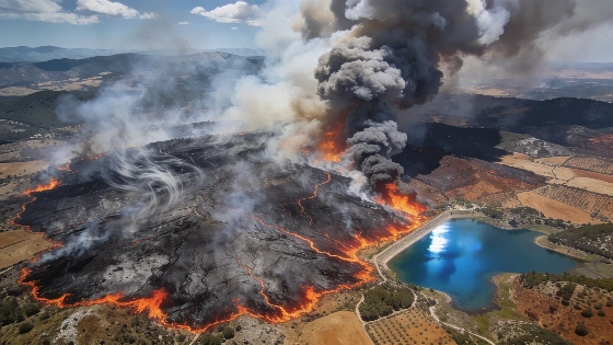
Strong winds pushed wildfires in Ávila and Madrid to unprecedented levels. Over 45,000 hectares burned in Burgohondo alone. Satellite images show the scale and rapid spread of the disaster.
Wildfires in Ávila and Madrid have reached historic proportions after powerful winds dramatically altered their course and intensity. On Friday afternoon, gusts exceeding 65 km/h swept through the region, rapidly expanding the area affected by flames and pushing the fires beyond previous containment lines. The result: more than 45,000 hectares burned in Burgohondo (Ávila), with the devastation clearly visible in recent satellite imagery.
Shortwave infrared (SWIR) satellite images captured at 13:00 on Sunday reveal the full extent of the disaster. These images, which penetrate smoke and highlight both active fires and scorched terrain, show the massive burn scar left by the Burgohondo fire. To the east, the Sierra Oeste fires—originating in the Community of Madrid—have consumed over 19,000 hectares. The two fire fronts have now converged near the San Juan reservoir, creating a single, vast area of destruction.
The rapid escalation of the fires has been directly linked to the abrupt change in wind direction and speed. According to data published by El País, the merging of the Burgohondo and Sierra Oeste fires was a critical turning point, allowing the flames to cover record distances in a matter of hours. Emergency services have struggled to respond as the fires moved unpredictably, with containment efforts hampered by shifting weather conditions.
Satellite monitoring has become essential for tracking the progress of these wildfires. The use of SWIR technology enables authorities to assess the situation in real time, even when thick smoke obscures ground-level visibility. This approach has provided crucial information for coordinating firefighting operations and evaluating the scale of the damage.
For residents and local authorities, the impact of these fires is immediate and severe. The burned area in Ávila alone now ranks among the largest in recent Spanish history. The convergence of multiple fire fronts near the San Juan reservoir has complicated evacuation plans and increased the risk to nearby communities. As the situation evolves, officials continue to monitor wind patterns and prepare for further changes in fire behavior.
These events follow a series of severe wildfires across central Spain in recent years. In a related incident, thousands were forced to evacuate as flames threatened 19 towns in Castellón, highlighting the growing challenge of wildfire management in the face of extreme weather. Details on that emergency can be found in this report: Castellón evacuations amid wildfire crisis.
Spain's wildfire season has become increasingly unpredictable, with wind-driven events like those in Ávila and Madrid underscoring the need for advanced monitoring and rapid response. The reliance on satellite data and real-time analysis is now central to managing such large-scale emergencies. As authorities assess the aftermath, the focus remains on protecting residents, restoring affected areas, and adapting strategies to address the evolving risks posed by extreme weather and wildfire activity.