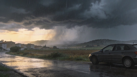
Storms will cross parts of mainland Spain on Monday, 5 October 2026. Girona faces torrential rain overnight, high rainfall totals during the day, swollen rivers and local flooding.
A stationary DANA west of Portugal will keep central and northern mainland Spain unsettled on Monday, 5 October 2026. Showers and thunderstorms may form from the first hours of the day.
Girona faces the highest risk. Storms may reach torrential intensity during the early hours, with more rain expected through the day. Strong showers may also affect the two plateaus, the Balearic Islands and several inland areas.
The wider forecast includes the mountains of the northwest, the interior east, the Central System and eastern Catalonia. The rain will not stay in one region.
AEMET expects significant accumulated rainfall across eastern Catalonia, although totals should be lower than in previous days. Some storms in the interior east and eastern Catalonia may become strong and produce hail.
The agency warned of torrential rain in Girona during the night into Sunday and on Monday. It also pointed to very heavy precipitation in the provinces of Girona and Barcelona.
Meteocat raised the rainfall danger level to 6 out of 6 and warned that some areas could receive more than 40 mm in 30 minutes, 90 mm in three hours and 200 mm in 24 hours.
The rain may be uneven rather than continuous. The episode is still wider than a short local shower.
Meteocat's maximum rainfall warning covered parts of Barcelona, Tarragona and Girona. Eastern Catalonia was facing a regional spell of dangerous weather.
That is the main concern.
Alongside Girona, the forecast covers the two plateaus, the mountainous northwest, inland areas of the east and the surroundings of the Central System. Eastern Catalonia may record significant totals during the day. The Balearic Islands are also expected to see showers and storms.
The latest outlook follows the weather concerns described in an earlier Catalan report. Northeastern Spain remains at the centre of attention.
Catalan Civil Protection introduced movement restrictions and sent ES-Alert warnings urging people to avoid non-essential travel. In Girona, the measures covered counties including Alt Empordà, Baix Empordà, Garrotxa, Gironès, Pla de l’Estany, Ripollès and Selva.
Rainfall totals are only part of the risk. Authorities warned about rising rivers and streams around Girona, including the Ridaura and Daró. Residents were told to stay away from their banks.
Euronews and local Catalan sources reported that two people had died and one remained missing in Catalonia amid the rain and flooding. The emergency has already caused deaths.
Canary Islands will see a different pattern, with mostly slightly cloudy skies. Temperatures will change little in the archipelagos. Maximum temperatures will rise across the rest of the country, while minimum temperatures should remain broadly stable.
Wind will vary by region. Moderate easterly winds are forecast in the Strait of Gibraltar, the Alboran Sea and Menorca. Northeasterly winds will affect the coasts of Galicia and Catalonia. Trade winds in the Canary Islands will range from light to moderate.
The region was already carrying a heavy moisture load after earlier extreme rainfall. Catalan News reported that more than 250 mm had fallen in parts of southern Catalonia. Local catchments were already under pressure.
Several regions may see showers or storms on Monday. Girona faces the sharpest mix of risks: torrential rain overnight, significant rainfall during the day, rising rivers, local flooding and travel disruption.
Officials are watching Girona closely.