France issues orange and yellow alerts for heat and storms in 60 departments. Temperatures reach up to 40°C, with Paris under warning. Violent storms and hail expected from August 2 to 4.
France is under heightened weather alert as a persistent heatwave and the threat of violent storms prompt authorities to issue orange and yellow warnings for 17 and 43 departments respectively. The alerts, in effect from Sunday, August 2 at 17:00 until Tuesday, August 4 at 9:00, cover much of the Centre-East and South-East, with Paris and surrounding regions also impacted by soaring temperatures and unstable conditions.
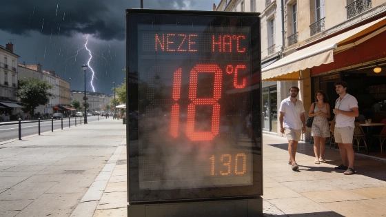
Daytime highs are pushing 35 to 38°C across large areas, with local peaks nearing 40°C. Nighttime relief remains elusive, as temperatures often stay above 20 to 25°C, making conditions particularly challenging for residents. The heatwave is expected to persist into the start of the week, with the most intense heat focused on the East, while the South-West, Centre, Lorraine, Hauts-de-France, and Île-de-France—including Paris—are also experiencing unusually high temperatures.
Alongside the heat, a significant deterioration in weather is forecast between Monday and Tuesday. Strong thunderstorms are set to sweep from the South-West through the Centre and into the East, bringing risks of heavy rainfall, hail, and damaging wind gusts. The alert comes as meteorological stations in the South-East and East report exceptional readings: 39.7°C in Coublevie (38), 39.6°C in Grospierre (07), and 39.1°C in Espalion (12), among others. Lyon recorded 36.2°C, while Albi reached 38.2°C, underscoring the widespread nature of the heat.
Monday morning will see the first storms erupt in the South-West, from Aquitaine and the Pyrenees to Limousin, gradually moving northward toward Centre-Val de Loire. Initially scattered and mainly electrical, these storms will intensify by midday as they reach Burgundy and Champagne. After a brief lull, a more organized wave of storms is expected to cross the Pyrenees mid-afternoon, spreading rapidly by evening and overnight from the centre to the North-East, including the Lyonnais and Franche-Comté. These storms may bring hail, intense rainfall—up to 50 mm in an hour—and strong gusts, raising the risk of localized flooding.
By Tuesday, the storm system will continue to affect the East, where vigilance remains necessary. Meanwhile, temperatures will stay high between Rhône-Alpes and regions north of the Seine, with a temporary dip near the Mediterranean before another surge is expected on Wednesday. The return of the mistral and tramontane winds could further elevate fire risks in the South-East due to the foehn effect.
This pattern of extreme weather follows a broader trend of volatile summer conditions in Western Europe. As noted in a recent report on the abrupt weather shift in Bizkaia, sudden changes between heat and storms are becoming more frequent, challenging local authorities and residents alike.
France's alert system uses color codes to indicate risk levels, with orange signaling significant danger and yellow denoting heightened vigilance. Such warnings are crucial for public safety, especially as heatwaves can strain health services and infrastructure, while severe storms may disrupt transport and cause property damage. Residents in affected areas are advised to monitor updates and take necessary precautions, particularly vulnerable groups such as the elderly and those with health conditions. The ongoing situation highlights the importance of preparedness as climate patterns continue to produce more extreme and unpredictable events across Europe.