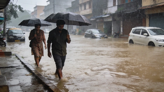
A strong low-pressure system is set to trigger intense monsoon rains across central and northern India. The India Meteorological Department warns of heavy downpours in several states. Localized flooding and travel disruptions are possible.
Central and northern India are bracing for another round of intense monsoon rainfall as a well-marked low-pressure system moves west-northwest across the region. According to the India Meteorological Department (IMD), this weather system, currently centered over north Jharkhand and adjacent areas of southwest Bihar and southeast Uttar Pradesh, is expected to drive heavy to very heavy rain in several states on Thursday, August 20.
The IMD forecasts that Chhattisgarh, East Madhya Pradesh, and West Uttar Pradesh will experience the most severe rainfall, with isolated locations likely to see significant downpours. Additional heavy rain is anticipated in East Uttar Pradesh, Uttarakhand, Himachal Pradesh, Jammu and Kashmir, Ladakh, and parts of the Northeast, including Arunachal Pradesh, Assam, Meghalaya, Nagaland, Manipur, Mizoram, and Tripura. West Madhya Pradesh is also on alert for heavy rain at isolated spots.
The current weather pattern is being shaped by the weakened depression that transformed into a well-marked low-pressure area at 11:30 am IST on August 19. This system is forecast to continue moving west-northwest over the next 24 hours, affecting southeast Uttar Pradesh, northern Chhattisgarh, and northeast Madhya Pradesh. The monsoon trough, which now stretches from Firozpur through Karnal and Hardoi and extends toward Digha and the northeast Bay of Bengal, is further fueling the rainfall across these regions.
Rainfall is not expected to be limited to the most affected states. The IMD projects fairly widespread to widespread rain over West Madhya Pradesh from August 20 to 23, East Madhya Pradesh through August 25, and the Konkan and Goa region through August 25. In contrast, Delhi-NCR is likely to see only scattered showers on August 20, with rain expected in select areas rather than citywide. However, the region has already recorded notable rainfall, with isolated parts of Haryana and Delhi receiving heavy to very heavy rain between 8:30 am on August 18 and 8:30 am on August 19. Kalka registered 16 cm and Panchkula 10 cm during this period.
As the low-pressure system continues its west-northwest trajectory, the risk of localized flooding and travel disruptions remains elevated for the affected states. The IMD advises residents and authorities to stay alert for rapidly changing weather conditions. This active monsoon phase follows a period of unstable weather in the region, as seen when orange weather alerts were issued for heavy rain and storms across Spain, highlighting the widespread impact of seasonal weather systems.
For context, the Indian monsoon is a critical annual phenomenon, delivering the majority of the country's rainfall between June and September. The monsoon's progress and intensity are closely monitored due to their direct impact on agriculture, water resources, and daily life. Low-pressure systems, such as the one currently affecting central India, are common drivers of heavy rainfall during this period. The IMD's warnings are crucial for local authorities to prepare for potential flooding, landslides, and disruptions to transport and infrastructure. Residents in the highlighted regions are urged to follow official updates and take necessary precautions as the wet spell continues.