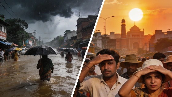
The India Meteorological Department forecasts severe rainfall for Sikkim and the northeast, while Uttar Pradesh and Delhi brace for continued heatwave. Monsoon progress divides the country, raising concerns over flooding and extreme temperatures.
India faces a sharp weather divide as the India Meteorological Department (IMD) issues a warning for extremely heavy rainfall in the northeast and parts of the east, while heatwave conditions continue to grip the northern plains. On Monday, Sikkim, Sub-Himalayan West Bengal, and the hills of the northeast are expected to see the most intense downpours, with some areas likely to receive over 20 cm of rain in just 24 hours. Such rainfall levels can quickly flood low-lying streets and disrupt daily life.
Beyond the mountainous regions, isolated pockets in Arunachal Pradesh, Assam, and Meghalaya are also on alert for very heavy rain, with similar warnings extended to parts of Kerala. Other states, including Bihar, Odisha, Telangana, coastal Karnataka, Konkan and Goa, Maharashtra, and Tamil Nadu, are forecast to experience heavy showers, according to the IMD.
Thunderstorms, lightning, and gusty winds reaching up to 60 km/h are expected across a wide swath of the country, stretching from the northeast down to the southern peninsula. The IMD notes that the monsoon has yet to cover the entire nation. As of June 28, the northern limit of the southwest monsoon extended through Surat, Indore, Mandla, and Motihari, leaving much of Uttar Pradesh and the Delhi region under hot, dry conditions.
Heatwave warnings remain in effect for isolated areas of Bihar, Uttar Pradesh, and the Haryana-Chandigarh-Delhi belt. In these regions, temperatures are forecast to reach 40°C to 42°C, with Delhi likely to see a brief spell of evening rain and gusty winds. The IMD defines a heatwave as a day when temperatures in the plains hit at least 40°C and remain significantly above normal. On June 27, Phalodi in Rajasthan recorded a high of 43.8°C.
The current weather pattern is driven by two main factors. The first is the monsoon trough—a belt of low pressure stretching from Punjab to Bihar—which channels moist sea air into eastern India. The second is orographic lifting, where the terrain forces moist air from the Bay of Bengal to rise over the eastern Himalayas and Khasi Hills, resulting in intense rainfall. This mechanism explains why Sikkim and Meghalaya frequently top national rainfall charts.
Additional cyclonic circulations over Madhya Pradesh, the Arabian Sea, and Telangana are contributing to increased rainfall in central regions. The IMD also reports that the next western disturbance, a rain-bearing system from the Mediterranean, is expected to reach northwest India by July 2, potentially bringing relief from the heat in the plains.
For context, Mawkyrwat in Meghalaya recorded an exceptional 39 cm of rain in the 24 hours leading up to June 28, highlighting the intensity of the current monsoon phase. The combination of heavy rain and persistent heat underscores the challenges of India's seasonal transition, with authorities monitoring both flood and heat risks closely.
While Spain is not directly affected by these developments, the situation in India offers a reminder of how rapidly weather extremes can shift. Recently, the Madrid region experienced a sudden end to its own heatwave, as described in this report on the abrupt temperature drop following days of extreme heat. Such contrasts highlight the unpredictability of weather patterns across different regions.
India's monsoon typically arrives in early June and progresses northward, but its advance can be uneven, leaving some areas exposed to prolonged heat. The IMD's forecasts are closely watched by millions, as both excessive rain and extreme heat have significant impacts on agriculture, infrastructure, and daily routines. The coming days will be critical for regions under alert, as authorities prepare for potential flooding and continue to monitor temperature spikes in the north.