Málaga remains under orange alert as temperatures approach 41°C. Coín leads with 40.8°C, while Estepona and Manilva also see extreme heat. Nighttime lows stay above 25°C, raising health concerns.
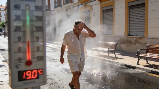
Temperatures in Málaga province soared close to 41°C on Monday, prompting the State Meteorological Agency (Aemet) to maintain an orange alert for high temperatures. The most intense heat was recorded in Coín, which reached 40.8°C at 18:00, making it the hottest spot in the region. Estepona, Manilva, and Málaga Airport also reported highs near 40°C, while central Málaga saw slightly lower values, with the city centre registering 36°C.
The ongoing terral wind, known for its dry and hot characteristics, was the main driver behind the spike in temperatures. According to Aemet, the orange alert—indicating moderate risk for the population—remains in effect for the western Costa del Sol, the Guadalhorce Valley, and the capital. The agency warned that maximums could again reach 40°C on Tuesday, especially in the Guadalhorce area, with minimum nighttime temperatures staying around 25°C. Such 'torrid' or 'equatorial' nights, when the mercury does not drop below 25°C, are particularly challenging for residents, as they make restful sleep difficult without air conditioning or fans.
Humidity levels played a significant role in the perceived heat. In some areas, such as Avenida Ortega y Gasset, humidity dropped to 25%, intensifying the dry heat. Meteorological communicator José Luis Escudero highlighted that if similar temperatures occurred with higher humidity, the thermal sensation would be even more oppressive. The terral effect was most pronounced in the upper Guadalhorce Valley and the western coastal areas, while the city centre experienced slightly milder conditions.
Looking ahead, Aemet forecasts that the orange alert will continue along the coast on Tuesday, with the possibility of another day of extreme heat. By Wednesday, the influence of the terral wind is expected to weaken, and the alert level will be downgraded to yellow. Relief is anticipated from Thursday, 6 August, when easterly winds (levante) are set to arrive, causing temperatures to drop by around eight degrees. Daytime highs in Málaga are expected to return to seasonal norms of about 30°C, and nighttime lows should fall to 21–22°C. However, the arrival of the sea breeze will increase humidity, which could lead to uncomfortable conditions if accompanied by cloud cover or haze.
July 2026 has been one of the warmest on record for Málaga, though it did not break historical records. As noted by José Luis Escudero, last month was the third hottest July since records began at Málaga Airport, with an average temperature of 28.2°C. Only July 2023 (29.4°C) and July 2015 (28.3°C) were hotter, highlighting a trend of increasingly warm summers in recent years. Nationally, Spain matched its previous record for July, with a provisional average of 25.7°C, equalling the value set in July 2022. This pattern of extreme weather is not unique to Spain; for example, Western Switzerland recently faced similar record-breaking heat and severe storms, underlining the broader European impact of this summer’s climate events.
For residents and visitors in Málaga, the current heatwave underscores the importance of staying hydrated, avoiding outdoor activity during peak hours, and taking precautions during hot nights. The persistence of high nighttime temperatures is a particular concern for vulnerable groups, as it can exacerbate health risks and strain local healthcare resources. The terral wind, while a familiar phenomenon in the region, continues to challenge daily life and highlights the growing need for adaptation to increasingly frequent extreme weather events.