A cold front disrupts Spain’s weather, triggering storms, hail, and strong winds. Temperatures fall sharply across most regions, with only the Mediterranean coast and Balearic Islands escaping the drop.
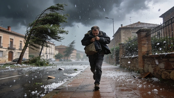
Spain faces a sharp shift in weather conditions this Thursday as a cold air front moves in from the north, breaking the recent period of atmospheric stability. The change brings widespread instability across the peninsula and the Balearic Islands, with heavy cloud cover and locally intense showers expected, especially in the northern third of the country. In eastern regions and the Balearic archipelago, storms may be accompanied by hail, raising concerns for both residents and local authorities.
Elsewhere, variable cloudiness will persist, and while most areas will avoid the heaviest rainfall, occasional showers cannot be ruled out. Winds are forecast to be moderate, but the southeast, Ebro Valley, Balearic Islands, and the Alboran Sea could see very strong gusts, potentially disrupting daily activities and transport.
Temperatures are set to drop significantly across almost the entire peninsula, with the most pronounced decrease in interior regions where daytime highs will fall well below recent averages. However, the Mediterranean coast and Balearic Islands will buck this trend: minimum temperatures there continue to rise, leading to tropical nights above 20°C and daytime highs once again surpassing 35°C. This contrast highlights the uneven impact of the cold front across Spain.
In the Canary Islands, the situation remains more stable. The northern slopes of the islands will see overcast skies, while the south enjoys clearer conditions. Temperatures are expected to remain steady, and moderate trade winds will persist, offering a respite from the more turbulent weather on the mainland.
The anticipated drop in temperatures could aid firefighting efforts in the Las Hurdes region of Cáceres, where a major forest fire has already forced the evacuation of around 700 residents from eleven communities and burned at least 2,200 hectares of pine forest. Authorities describe the fire as "convective," with such intensity that it has generated its own wind and temperature, making direct intervention impossible during the initial hours. Firefighters have had to contend with a self-sustaining column of hot air that fueled the blaze’s advance.
Weather disruptions are not limited to this event. Earlier this week, much of Spain was placed on alert for extreme heat, storms, and wildfire risk, as detailed in a recent report on rising temperatures and fire hazards. The current cold front marks a rapid reversal, underscoring the volatility of Spain’s summer weather patterns.
Spain’s varied geography often leads to sharp contrasts in weather, with Atlantic fronts bringing sudden changes that can impact agriculture, tourism, and daily life. The combination of storms, hail, and strong winds increases the risk of localized flooding and property damage, particularly in areas unaccustomed to such abrupt shifts. For residents and travelers, staying informed about local forecasts and official advisories remains essential during periods of heightened meteorological activity.